Mobile Application Development for Drone Airspace Compliance – MyFlyZone
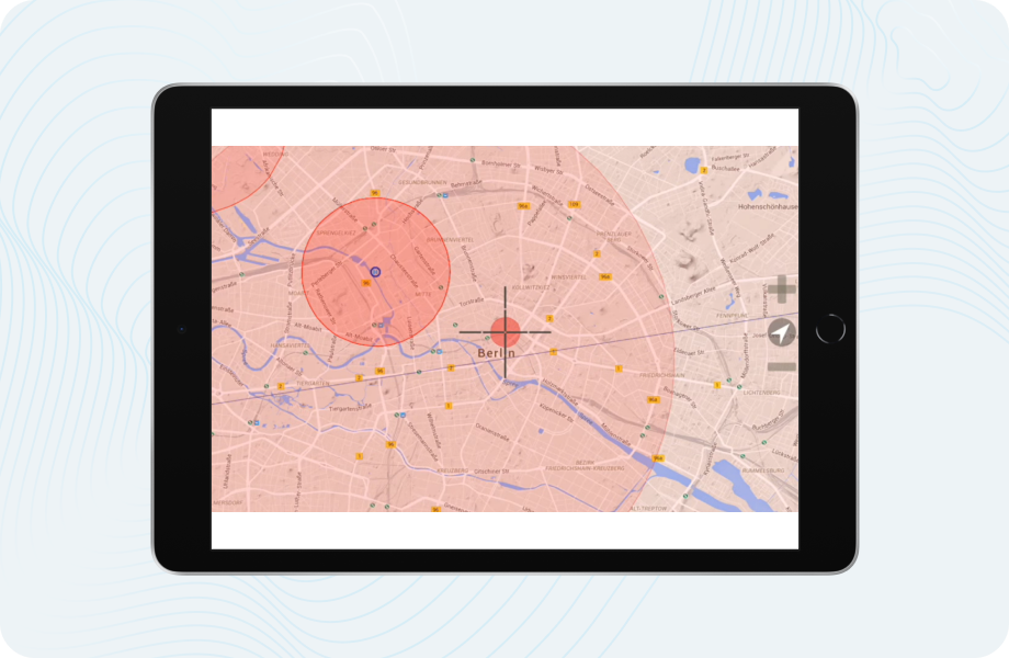
MyFlyZone was developed to support drone pilots in flying safely and within German airspace regulations. IT Craft developed a mobile solution with real-time maps, visual alerts, and integrated legal updates to support safe, informed flying.
- Type Safety-focused mapping app
- Industry Drones, Mapping, Aviation
- Platforms iOS; Android
About the project
IT Craft built MyFlyZone from the beginning as a cross-platform mobile app using Appcelator Titanium. It added the integration of Google Map, real-time location, locked area overlays, all in accordance with German airspace law.
It enables operators of drones to utilize interactive no-fly maps, get notifications of legal compliance, and move at ease through congested skies.
It has been made user-centric, regulatory-centric, and user-friendly, in short, so that drone professionals and hobbyists can fly safely without penalties and no-go zones.
Eventually, a multiplatform mobile app featuring maps, real-time geolocation, and functionality to facilitate the legal approval of drone flights in German skies would be created.

Client’s expectations
- Build a safety-focused mobile app for drone operators
- Provide clear, real-time maps with restricted airspace visualization
- Ensure compliance with up-to-date German flight laws
- Deliver seamless cross-platform support for iOS and Android
- Offer an intuitive interface accessible to all pilot levels
Technologies:
 Appcelerator Titanium
 Google Maps
Geolocation
 Laravel
 Azure
Azure PostGre
 PostGIS
 OpenStreetMap API
 MySQL
MySQL
We delivered:
- A fully functional mobile app for airspace safety
- Cross-platform support with a single codebase (iOS & Android)
- Seamless integration of maps, zones, and legal data
- Backend infrastructure supporting location processing
- Intuitive interface tailored to drone pilots’ needs
To bring this vision to life, IT Craft applied its mobile application development services, creating a secure and user-centric solution for drone flight safety.
Results of the collaboration
MyFlyZone was launched as a regulation-ready drone app offering visual guidance and legal zone tracking. The product gained user trust by promoting safe, informed, and compliant drone operations.
- Real-time map-based drone safety platform
- Compliance with German aviation regulations
- Competitive positioning in the drone app niche
- Positive reception by both novice and professional pilots
To support safe and compliant drone operations, IT Craft delivered a user-friendly, scalable solution—built with precision through expert mobile application development services.