Social Media App Development for the Outdoor Community
ViewRanger is a location-based social mobile app where outdoor lovers explore, map, and share their journeys. IT Craft helped bring this idea to life by creating an intuitive app with strong community functionality, real-time mapping, and seamless cross-device access.
- Team 6 team members
- Type Tourism & Social Platform
- Industry Travel Tech / Outdoor Activities
- Platforms Mobile, Web
About the project with ViewRanger
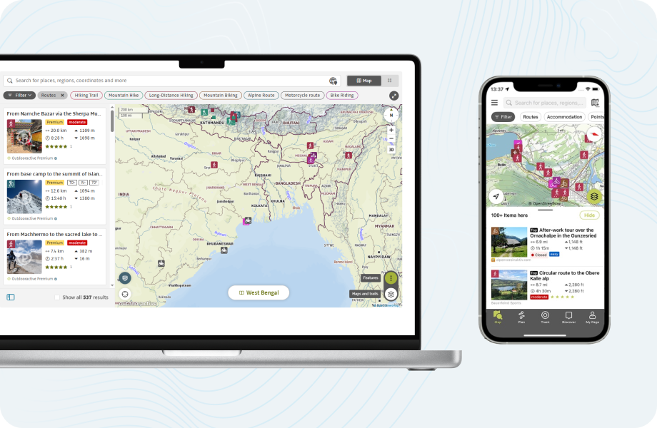
IT Craft helped ViewRanger turn their concept into a full-fledged location-based social media platform by designing and developing both the mobile app and web system from the ground up.
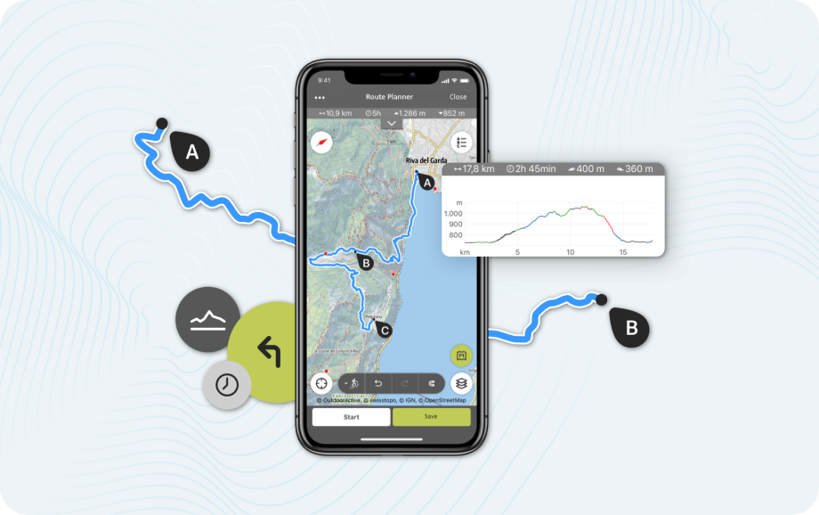
The application supports mapping of outdoor paths, uploading of GPX traces, overlaying various map layers, and sharing tips among fellow members — all of this in real-time.
A client hoped to construct a place where hikers, bikers, and outdoor enthusiasts would meet, socialize, and find new adventures.
Its central role has been to integrate map navigation with social interaction, to provide an online community space for connection, interaction, and belonging between like-minded outdoor users.
Client's expectations
- Build a mobile-first platform with route creation and social networking tools
- Enable integration with third-party map providers (Google Maps, OpenStreetMap, OpenCycle)
- Allow users to upload and share GPS-based routes in real time
- Reduce API costs by optimizing calls to Google Maps & Elevation services
- Ensure responsive web and mobile experiences
- Support a scalable backend to handle growing user activity
Services we provided for ViewRanger
Technologies:
 HTML5
HTML5 CSS3
CSS3 Mootools JS
 ExtJS (backend interface)
 PHP
PHP Zend Framework
 SOAP
SOAP MySQL
MySQL Google Maps API
 Twitter SDK
 Facebook SDK
ViewRanger came to IT Craft with a mission to blend outdoor exploration with social engagement.
We brought that concept to reality by engineering a mobile-first platform that enables users to plan, record, and share outdoor activities while staying connected to a like-minded community.
Our scope covered both product vision and technical execution. We created a flexible solution that merges geolocation, user-generated content, and social functionality. Our key contributions included:
- Developing multi-layer map navigation with real-time route building
- Parsing large GPX files from a wide range of tracking devices
- Integrating Twitter and Facebook SDKs for instant route sharing
- Optimizing the system to reduce costly Google Maps API requests
- Enabling route saving, history tracking, and friend interaction
- Delivering a seamless cross-platform experience
Results of the collaboration with ViewRanger
In just one year, IT Craft delivered a polished and performance-driven product that helped ViewRanger become a go-to platform for outdoor enthusiasts.
- Successfully deployed web and mobile app with integrated social features
- Empowered users to connect, share routes, and build a trail-based community
- Streamlined map tools and GPX handling for flexible route planning
- Minimized API usage while maintaining functionality
- Positioned ViewRanger for rapid organic growth within the travel and outdoor niche
IT Craft offers full-cycle social media app development, helping businesses build engaging, scalable platforms with real-time interaction and custom community features.