Step into the future of shopping with the latest revolution in retail experience – Indoor Navigation inside Shopping Malls! Gone are the days of aimless wandering and missed deals. With a cutting-edge Mall Navigation App, every visit becomes a seamless journey of discovery and convenience.
From pinpointing your favorite stores to uncovering hidden gems, this article will unveil how modern technology transforms your mall visits into an efficient, enjoyable, and futuristic adventure. Get ready to navigate the vast expanse of shopping malls with ease and sophistication like never before!
1
Why do users need indoor navigation apps?
An advanced indoor navigation app helps solve many issues businesses and customers face. It provides a plausible mix of ecommerce and physical shopping experiences for three user groups:
- customers
- businesses
- facility owners
Indoor navigation apps can be used for:
- navigation and mapping
- promotional and alert notifications
- tracking and analytics
Customers
For customers, indoor navigation apps are a game-changer. These apps provide real-time directions, helping shoppers locate stores, restaurants, or the shelf where the product is situated in large and often complex mall layouts.
They also offer information on current promotions and events and can even guide users to the nearest restrooms, parking spots, or exits.
By reducing the time spent searching for locations, customers enjoy a more relaxed and efficient shopping experience, leading to increased satisfaction and repeated visits.
Businesses
Businesses within these facilities greatly benefit from indoor navigation apps. By being part of an app’s directory, companies increase their visibility to potential customers.
The apps can provide businesses with valuable customer foot traffic pattern data, allowing for targeted marketing and optimized store layouts.
Additionally, businesses can send push notifications about deals and discounts directly to app users, driving in-store traffic and increasing sales opportunities.
Facility owners
Facility owners and managers find indoor navigation apps useful for effectively managing their spaces. These apps offer insights into how spaces are utilized, enabling owners to improve facility layouts based on actual usage data.
Enhanced customer experience through easy navigation leads to longer visits and potentially higher spending, benefiting the overall profitability of the facility.
Furthermore, these apps can be integral in emergencies, providing crucial information for evacuation plans and emergency services.
2
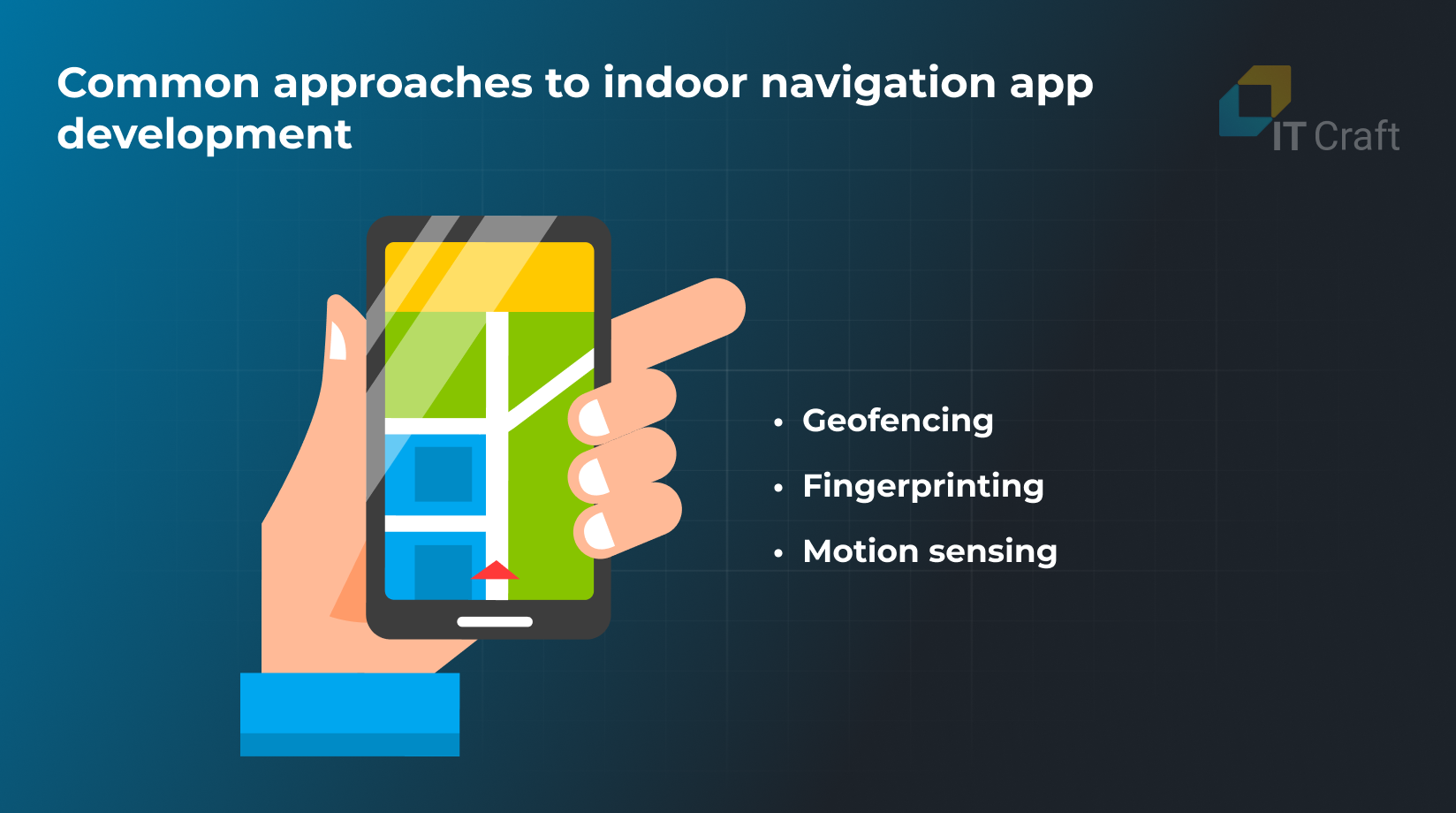
Common approaches to indoor navigation app development
Challenges with indoor navigation: venues require different positioning systems based on, among others:
- number and size of rooms, presence of metal moving obstacles
- number of floors in the building
To help overcome these challenges, the best shopping mall navigation happens when an indoor navigation app uses signals from various sensors for building and tracking the route.
Indoor navigation app development needs the following methods:
- Magnetic fields positioning
- BLE-based or WiFi-based
- Motion sensing
Geomagnetic fields
Positioning technologies based on the geomagnetic field are a reference for determining orientation and positioning within buildings, utilizing variations in magnetic intensity to assist in navigation without reliance on GPS signals—a unique geomagnetic field influenced by all interior items, architectural forms, steel beams, etc.
Such systems can function on most mobile devices—those equipped with a magnetic field sensor. Geofencing systems have an accuracy from 2m to 3 m max.
Bluetooth Low Energy (BLE) Beacons
These devices are designed to work with both iOS and Android platforms, emitting signals that can trigger notifications or actions based on the user’s proximity within a mall. They are a key component in indoor navigation systems, allowing for precise location-based interactions.
Motion sensing
On-board smartphone sensors help control the motion. The sensors include:
- accelerometer
- compass
- gyroscope
- barometer
Their combination helps measure 3D motion both on one floor and between different floors in a mall.
Motion sensing is precise within approx. 3 ft. – 6.5 ft. (2 – 3 meters) for users moving inside the building.
Ready to explore the world of indoor navigation app development?
Discover the key strategies and technologies shaping this exciting field with experts.
Contact Us
3
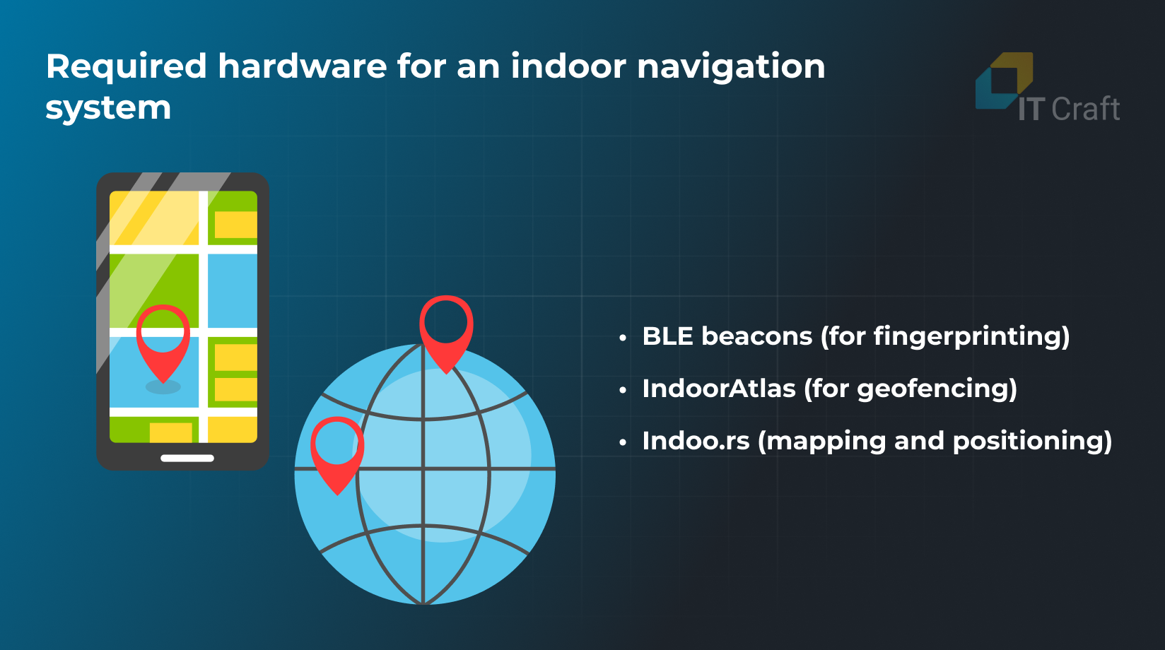
Required hardware for an indoor navigation system
Visitors only need their smartphones to use an indoor navigation app. Steps include:
- Launch the locale-specific smartphone app.
- Turn on BLE (Bluetooth Low Energy).
- Turn on the Internet connection/Wi-Fi.
To provide visitors with both precise indoor navigation apps and engaging location-based experiences, navigation app owners must install special hardware and utilize indoor positioning platforms.
The most common technologies include:
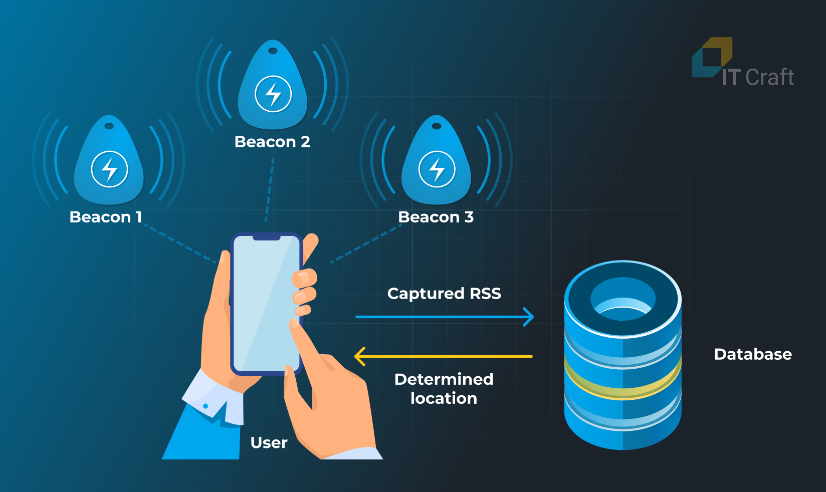
BLE beacons (for navigation)
There are various BLE beacons available. They differ in features, price, and shipment options. For example, the Estimote indoor location solution is based on miniature beacons with a processor, memory card, battery with a one-year shelf life, accelerometer, and temperature sensor.
Three beacons must be installed inside a room to cover the entire space.Mobile devices read signals from the beacons and use them to determine the location.
However, positioning becomes difficult when any reflecting surface or large shielding objects, including people, are situated near the beacons, or many are gathered together in one place. Thus, calculation results might have an accuracy of up to appr. 10 – 20 ft. (3 – 6 meters.)
Wi-Fi
Wi-Fi infrastructure, already prevalent in many indoor environments, can be leveraged for indoor navigation. An app can estimate the user’s location by measuring the strength of Wi-Fi signals (RSSI) from multiple fixed access points.
This method requires a detailed map of Wi-Fi access points and their signal strength across the area of interest. Wi-Fi-based navigation is beneficial as it utilizes existing network infrastructure, reducing the need for additional hardware installation.
UWB (Ultra-Wideband)
UWB technology offers precise distance measurement and location tracking capabilities by using radio waves with a very low energy level for short-range, high-bandwidth communications over a large portion of the radio spectrum.
UWB beacons are placed throughout the building to provide spatial context and enable accurate distance measurement between the device and the beacons, facilitating pinpoint location tracking within the indoor environment.
4
Indoor navigation app development: components, features, and costs
System components
Developers need to integrate several technologies into one seamless indoor navigation solution. Indoor navigation software consists of the following parts:
- User smartphone app – receives and sends requests; displays results of user requests.
- Tracking hardware and engines – transmits signals and tracks devices.
- Software back end – stores maps and calculates user routes. Routing requires heavy calculations and quickly drains a smartphone battery.
- Administration panel – lets admin manage hardware and software.
Core features
It lets users find the best way to their destination. It includes the following core features:
- Positioning – find their exact location inside a shopping mall.
- Mapping – use the app map to orient in a shopping mall.
- Routing – receive assistance in route creation; use directions to find the destination.
Users also benefit from the following nice-to-have features:
- AR directions or voice guidance – improves guidance by visualizing the route.
- Logging in via an Android/Apple account frees users from memorizing another set of login credentials.
- Guest mode – suits users who prefer using the app in incognito mode.
- Find your friend – helps users find each other faster inside the shopping mall.
- App Clips – works for iOS users who want to try indoor navigation without installing the app.
- Indoor navigation for visually impaired users
Incorporating indoor navigation for visually impaired users is a key feature in digital mall navigation apps, demonstrating a commitment to accessibility and inclusivity.
This functionality is specifically designed to cater to the needs of shoppers with visual impairments, ensuring they can navigate shopping malls safely and independently.
The feature typically includes voice-guided directions, audio descriptions of store locations and layouts, recognition of user voice commands, and haptic feedback, which provide a supportive and autonomous shopping experience for visually impaired individuals.
This enhancement not only improves accessibility but also ensures a more equitable experience for all mall visitors.
It lets app admins manage the app. Two access levels include businesses operating inside a shopping mall and facility owners or their representatives.
They let users promote their stores and get analytics on visitors.
- Promotional notifications – inform customers about special offers and discounts.
- Front-store management links certain items to the user app and makes on-the-go purchases possible.
- Analytics – receive analytics via a heat map on how much time customers spend inside or in different mall areas. For example, how much time do users spend in a restaurant or fountain? Or in the dairy section of a supermarket.
- Features for facility owners
They and their representatives include:
- Beacons and map management – detect and eliminate flaws fast.
- Alert notifications – send users emergency notifications and activate instructions.
- Analytics – get insight on facility usage.
- Build trust and responsibility – helping visually challenged people and first-time visitors.
5
Advanced proximity-based marketing with BLE beacons
With advanced beacons, more features are possible for businesses. For example, Estimote Nearables can be attached to items. They have their memory, an accelerometer, and temperature sensors.
With the help of the accelerometer, Estimote Nearables can identify changes in an item’s position. They can collect analytics on how often the thing with the attached beacon was touched, thus determining its popularity.
Or, Estimotes can activate a TV screen inside the store. The screen displays useful information such as item materials, price, discounts, “customers also bought this item,” and more.
Kontakt.io offers even more sensors for installation into every beacon.
App owners can choose the desired components from the following list:
- accelerometer
- environmental temperature sensor
- weight sensor
- gyroscope
- humidity sensor
- light sensor
- linear acceleration sensor
- magnetic field sensor
- orientation sensor
- pressure sensor
- rotation sensor
These sensors help monitor the environmental conditions and their changes in real time.
For business owners, administrators, and managers, this function can become essential for monitoring the storage conditions and observing all required standards.
6
Costs of Indoor Navigation Development
An indoor navigation app costs between $30,000 and $350,000 for a basic app. They increase when extra features are added to the system.
Indoor navigation development costs depend on the following:
Integration of Navigation Technologies
While integrating various navigation technologies can enhance an app’s precision, it’s important to note that only one navigation technology provider is typically used for any mall section.
The idea that adding more technologies improves precision might be misleading since, within the same area, utilizing multiple technologies from different providers does not necessarily offer additional benefits.
However, for other floors or sections of a mall, selecting various navigation technology providers can be a strategic decision to optimize costs and infrastructure needs.
Shopping mall area
The size of a shopping mall directly affects the number of BLE beacons developers need to buy, install, and tune. Also, the larger the area, the more time developers need to create maps.
Promotional features
A special server handles promotional notifications. It must be included in the scope of work.
Anticipated number of users
A large number of users requires more servers to handle requests. Software developers also need to pay extra attention to different types of load testing.
App maintenance
Last but not least, app maintenance is critical for app success. Maintenance costs take 15% to -20 % per year. The app owner must ensure an engineer or team constantly monitors the entire system:
- app server state
- beacons state
- geomagnetic maps
Also, app updates are important when navigation technologies or user smartphones receive updates.
Seeking insights and exploring innovations?
Begin crafting innovative navigation solutions today; embark on a journey of cutting-edge creation.
Contact Us
7
How does IT Craft work on indoor navigation app development?
At IT Craft, developers use a six-step path to indoor navigation development.
It includes the following steps:
Project discovery and estimates
As with any app, everything starts when you send a request to us with your requirements. If needed, a call is made to clarify any details. Based on your requirements, a project manager prepares an estimate. It includes the scope of work, timeline, and required team squad.
In the next step, we further discussed details and negotiated terms.
-

Due to high unpredictability, only a preliminary estimate is possible for indoor navigation projects. If you already have project requirements (and some source code), the team completes a pilot task to see if they can handle the project. After both parties agree on terms of cooperation, the contract is signed, and an NDA is also, if required.
Indoor navigation software development.
The development team collaborates with Agile to deliver the source code of the indoor navigation app. The Agile approach allows for working on different system parts simultaneously and handling changing requirements.
The entire workflow is divided into Sprints. At the beginning of each Sprint, we discuss the Sprint scope. You get a Sprint plan. After each Sprint, you get a part of the working functionality and a detailed report on hours worked.
The roles on an indoor navigation development project include:
- Project manager – Oversees the entire development workflow.
- Business analyst – Handles requirements; helps the team prepare user path.
- UX/UI designer – Works on the visual part of the app.
- Mobile developer – Prepares mobile app. Usually, there are at least two mobile developers, one for Android and another for the iOS app.
- Front-end developer – Develops administration panel.
- Back-end developer – Responsible for the server part. Usually, there are several back-end developers on an indoor navigation project.
- QA engineer – Ensures app quality and conformity to requirements.
- DevOps – Set up the server infrastructure.
Hardware installation and tuning
At this step, developers install beacons inside the facility and prepare maps. Physical testing starts. Developers walk through different levels and see how the system works. They also look for the best spots for BLE beacons to avoid being taken by visitors. When needed, developers fine-tune maps and beacons to make precise positioning possible.
Launch and user acceptance testing
You test the system at this step to see how it works and corresponds to your expectations. Beta testing by early adopters can ensure a large testing base. Tuning is also done at this step to meet requirements.
Post-launch software support
The development team supervises the project for the next 1 – 3 months, depending on the amount of produced source code. The unit eliminates bugs and source code flaws discovered when early adopters start operating the app. These fixes are included in our original estimate.
Software maintenance and expansion
The same development team can help you maintain your software available for end uses. They can add new features to the indoor navigation app and optimize source code.
If you plan to manage your indoor navigation solution on your own, please make sure you assign a person who can maintain both software and hardware parts.
8
IT Craft Expertise
Smart Navigation Systems: Revolutionizing Indoor Navigation
ITCraft played a key role in the success of Smart Navigation Systems, a UAE startup focusing on enhancing indoor navigation and positioning. The collaboration involved a dedicated team of 7 members.
The collaboration resulted in a cutting-edge indoor location tracking and marketing platform to help visitors easily navigate large facilities with turn-by-turn directions and BLE beacon notifications.
Project Highlights & Impact:
- Development of native iOS and Android applications for user navigation and a web-based admin panel for system management.
- Implementation across various facility types extends beyond consumer markets to campuses and offices.
Strategic Business Solutions:
- Introduced features like ‘Find-my-car’ for personal vehicle location within parking areas and ‘Outdoor-to-outdoor navigation’ for comprehensive guidance from outdoor locations to indoor destinations.
- Adopted a white-label approach, allowing businesses to personalize and privatize the navigation system for their facilities.
Recognition & Expansion:
The system’s versatility and innovative approach have set a new standard for indoor navigation solutions, offering scalable and customizable options for various facility types.
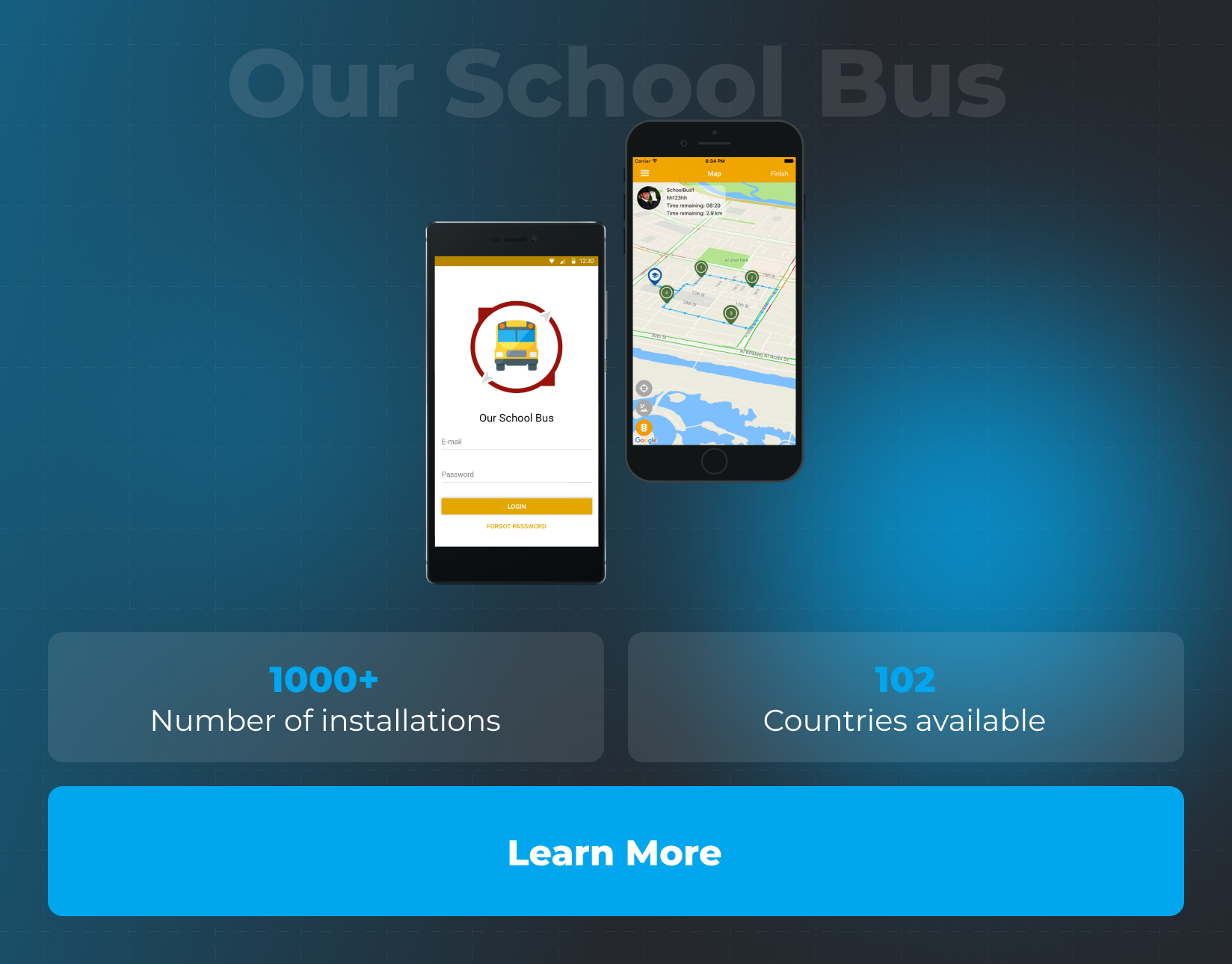
Innovating School Transportation
Partnering with UAE’s Smart Navigation Systems, ITCraft developed an advanced school bus tracking system, improving children’s transport safety and easing parental concerns.
The initiative led to the creating of the “Our School Bus” app, a real-time tracking solution for managing school bus fleets, ensuring student safety, and providing parents with peace of mind. It offers comprehensive features, including GPS bus tracking and iBeacon technology for student presence detection.
Project Outcomes:
- The system saw over 1000 installations and became available in 102 countries.
- A dual-app approach was adopted, providing separate mobile applications for parents and bus drivers alongside a web-based control panel for school administration.
Technical Highlights:
- The project’s complex architecture necessitated multi-role support within the system and power optimization for route tracking.
- The backend was designed to handle substantial data, ensuring reliability and efficiency.
!
Wrapping up: Indoor navigation inside shopping malls is required
Nowadays, indoor navigation has become so significant that many companies, from startups to world leaders like Google and Indoors, have released hardware and software solutions.
The features of a mall navigation app are greatly appreciated by people who love shopping—especially by those who value their time, create shopping lists, and want the optimal route to all necessary goods and services.
For a shopping center, up-to-date, highly available navigation provides an immense opportunity to distinguish themselves from similar shopping malls. They can improve their status and increase their competitive advantage.
This is crucial considering the large number of shopping centers in every big city. Customer attraction leads to an increase in the number of tenants inside a mall.