Indoor Location Services for Smart Navigation Systems
Smart Navigation Systems, a UAE-based startup, partnered with IT Craft to build a feature-rich indoor navigation platform with BLE beacons, 3D maps, and real-time tracking.
About the project with Smart Navigation Systems
IT Craft partnered with a UAE-based startup to build a scalable platform for indoor navigation and positioning across large facilities. We developed native mobile apps for end-users and a powerful web-based admin panel for facility and retail management.
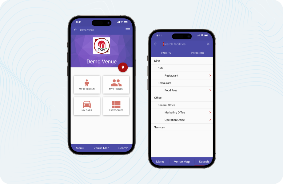
The app enables users to receive turn-by-turn guidance within large buildings, search points of interest, receive voice instructions, and get contextual notifications via BLE beacons. Shop and facility owners can manage content and track user behavior through the admin portal.
The client wanted to provide an all-in-one indoor location service to help people easily find their way in unfamiliar environments — while enabling businesses to gain insights and launch targeted in-facility promotions.
The goal was to build a modular, high-accuracy system that supports both real-time navigation for users and a marketing/analytics engine for B2B clients. The solution also needed to support cross-facility routing and white-label deployments.
Technologies:
 Android SDK
 Indoor Atlas
 Google Maps
 Socket
 Indoo.rs
 OpenGL
 Fresco
 Retrofit
 OkHttp
 Objective-C
 3D Map
 UIKit
UIKit MagicalRecord
 Typhoon
 Angular
 Yii Framework 2.0
 SwiftMailer
The client approached us with a concept for indoor navigation using BLE beacons, floor-based positioning, and custom mapping. Our role was to design and implement the full ecosystem — from native mobile apps and map rendering logic to backend services, admin panel, and real-time analytics tools.
We delivered:
- Consulting on architecture and positioning strategy
- Wireframes, UX flows, and modular system design
- Integration of Indoor Atlas, Indoo.rs, and OpenGL-based 3D mapping
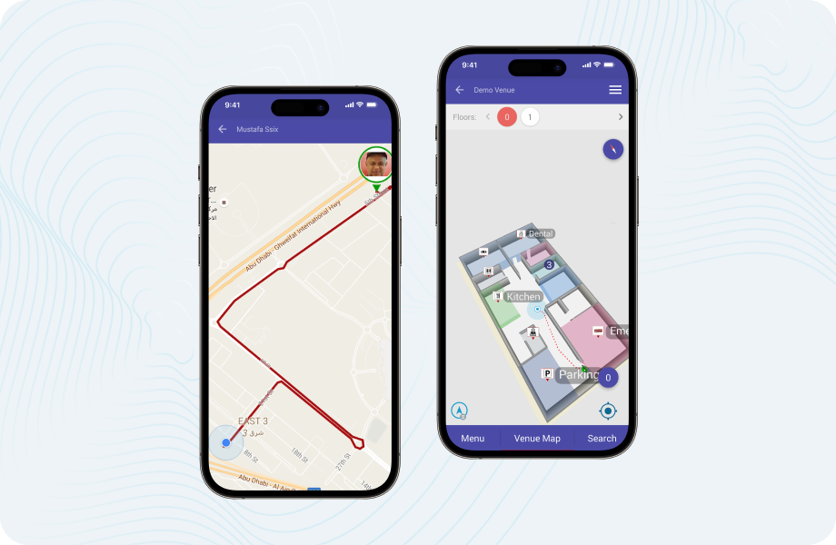
- Real-time BLE-based positioning with seamless floor transitions
- Web admin panel with role-based access for facilities and shop owners
- Friend tracking, child safety zone alerts, and find-my-car functionality
- Outdoor-to-indoor routing using Google Maps and internal pathfinding
Results of the collaboration with Smart Navigation Systems
The platform became a versatile indoor positioning and engagement solution, adaptable across diverse locations like malls, airports, hospitals, and industrial facilities. Key outcomes included:
- Improved visitor experience through seamless indoor navigation
- Valuable behavioral insights for shop owners and facility admins
- Operational flexibility across multiple industries and venue types
- Decreased user frustration in large or complex indoor spaces
- A modular, extensible architecture ready for white-label distribution
Looking to implement scalable navigation or tracking inside your facility? Explore our indoor location services to see how we can help you turn complex spaces into smart environments.