Indoor Location Services
Optimize facility usage with a custom-built system for indoor location tracking.
Our services allow you to combine different approaches, such as Wi-Fi, BLE, or geofencing, into one seamless solution.
Our Indoor Location & Navigation Services and Capabilities
Our engineers can help you take your indoor processes to the next level by delivering and customizing an indoor location solution that enhances your processes:

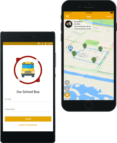
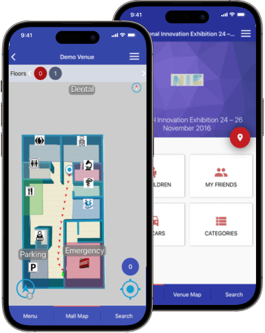
Fully Featured Indoor Navigation Solutions
Real-time navigation apps help manage busy venues, guiding users to a selected destination point. Our programmers integrate indoor location technologies of several types, ensuring accurate positioning inside different venue types.

Geofencing and Location-Based Systems
Geofencing helps determine user proximity and trigger an event based on that. It can increase safety, support context-based promotional campaigns, or improve navigation. We can build geofences, set up triggers, and detect user activities.

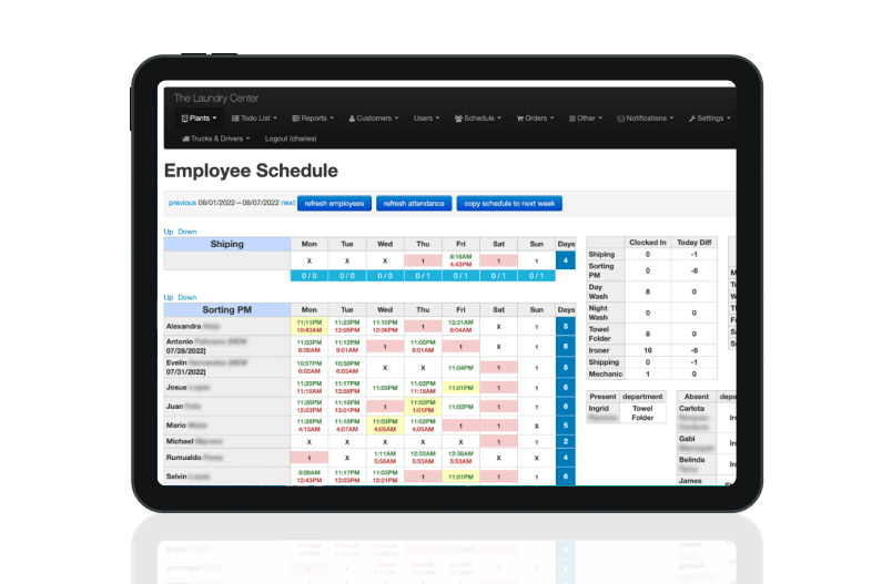
Employee Location Tracking Apps
Enhance access to restricted areas and improve rescuing procedures in an emergency with an indoor location system. Our engineers will build the required functionality to help you advance your safety and security procedures.

Forklift Location Management
An indoor forklift tracking solution could let you monitor forklift movements in real time, detect and eliminate inefficiencies in warehouse layout, and improve order execution. We can help with customized implementation.

Equipment Tracking
Systems
Custom solutions create the most value; they are the best fit when you need technical excellence. Our team provides necessary improvements by integrating technologies for precise “GPS location tracking” or introducing custom algorithms.

eKanban
Apps
Manage your spaces and processes efficiently with a real-time web system. Our development team can build an eKanban board or customize an existing solution, integrating indoor location tracking into it.

Make-to-Order Production Management
A custom system containing tracking functionality can help streamline the production of multiple small orders by assessing their up-to-date statuses. Our dedicated development team can deliver necessary features.

Digital Twin
Solutions
A digital twin solution can help you operate at peak efficiency by determining and monitoring optimal timings. Our developers can recreate your spaces, help you set up indoor location technologies, and ensure seamless data processing.
Indoor Tracking Systems: Our Case Studies


Our clients' success stories.
We love to hear what they say about us.
Stories of people impressed by our service offerings
Which indoor mapping technology is best for you?
Contact us. Let's determine the best implementation for you together.
Contact us


How Does Indoor Positioning Work?
Our specialists develop comprehensive software that integrates a number of technologies serving as "indoor GPS tracking," including geomagnetic maps, BLE beacons, and motion sensors. They also deliver a mobile app for users and a web-based admin panel for system management.
Reasons to Select Our Indoor Location Development Services
By building indoor navigation software with us, you can count on:
Value-focused solutions
Our engineers prioritize functionality that generates the most business value. If your requirements change, we adjust priorities.
Full-cycle services
You find all technical services needed to move your project from a concept to a fully featured system at a pace.
Data security
Our programmers implement data protection policies and high-security standards to ensure your indoor location services are safe and compliant.
Transparent communication
You get regular reports, test deliverables after each sprint, and participate in meetings with your dedicated team, ensuring everyone stays on the same page.
Technologies Used in Our Indoor Location Tracking Systems We Work With
-

Kontakt
-
Estimote
-

Indoor Atlas
-

Esri (Indoo.rs)
-

Kotlin
-

Swift
-

OpenGL
-

3D Map
-

Linux
-

Apache JMeter
-

MySQL
-

PHP
FAQ
Indoor location services focus on building a software system that provides digital representations of indoor spaces. The precise digital map of a floor that indoor location services operate on enables businesses to locate users and objects, create routes, and navigate visitors through buildings.
Here are the key purposes of providing indoor location services:
- provide turn-by-turn indoor navigation
- plan accessible routes for people with special needs
- track valuable assets and equipment to eliminate idle time
- monitor and optimize item movement inside large warehouses
- locate people for security and safety reasons
- create and execute promotional campaigns
- activate guided information when approaching an object
- collect analytics on visitor behavior, mapping busiest areas
There is no universal technology working for all space types and use cases.
You need to select a technology or a combination depending on your needs:
- BLE beacons for spaces with walls and notifications
- plan accessible routes for people with special needs
- geofencing for open spaces
- beacon tags and gateways for item tracking
- Wi-Fi as an alternative to beacons in busy places
- integrating data from smartphone hardware to increase calculation precision
The costs of building an indoor navigation system vary depending on the required feature list. Basic functionality can cost between $30,000 and $350,000. The estimate varies based on location and hourly rate of chosen software development provider.
Indoor navigation systems are complex solutions that require the integration of several technologies and fine-tuning to different user devices.
Indoor navigation development includes several steps:
- analyze facility and choose a technological stack for indoor location tracking (beacons, geofencing)
- purchase beacons and subscriptions for navigation engines
- build iOS/Android indoor location tracking apps
- develop a location-tracking app for wearables
- create a web admin panel
- map venue(s)
- install beacons
- tune and adjust
- beta-test
- launch for a wide audience